King City Section
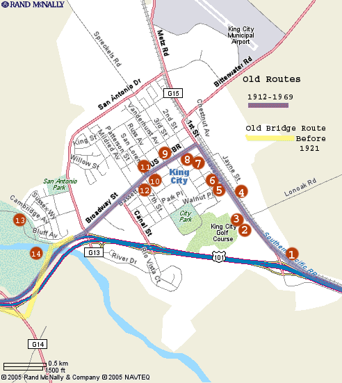
The King City section extends from the southern entrance to the town near the northbound off-ramp of the current 101 freeway at First St., and extends to a point about two miles north of town. The original highway route through King City, California followed the current freeway from the south up to First St.. It then turned northwest and continued into town on Main, then turned southeast on Broadway. Broadway is pretty much the main drag in King City, and the highway route came right through the center of town, before crossing over the Salinas river, and then continuing north to Greenfield. The bypass of King City, San Lucas, and San Ardo was adopted in 1962. This was the route from the early 1900's until 1968, when the bridge over the Salinas river was replaced, and the current freeway bypassed the center of town.
The history of King City dates back to 1884, when the founder, and namesake, Charles King, purchased 13,000 acres of the San Lorenzo land grant, and began to grow wheat. His success prompted the Southern Pacific to extent the rail line from Soledad to the area in 1886. The town was incorporated in 1911. From the beginning until the present day, King City has been a rich agricultural community, shipping some of the finest produce in the nation.
I'd like to give special thanks Susan Kelley, and Sharon Turner from the Monterey County Agricultural and Rural Life Museum in King City for allowing me to use some of the photos from their historical archives, and to Chris Cavette for providing additional information on several of the locations.

Location # |
Thumbnail |
Description |
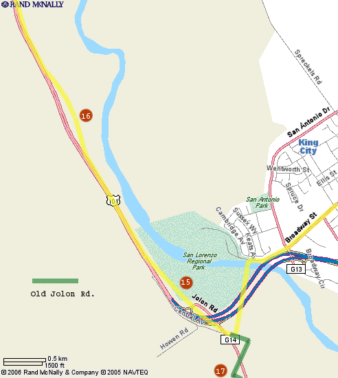
This map shows the two locations north of King City near the current 101 freeway.

Location # |
Thumbnail |
Description |
Comments, suggestions, and feedback are welcome
E-mail
me at: don@Historic101.com


